|
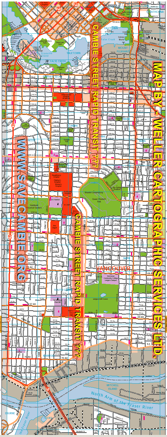
A reference map of Vancouver's Cambie Street/Boulevard shows it from the city's downtown (in the north) to its intersection with Marine Drive in the south. The Cambie Boulevard Heritage Society, www.savecambie.org is protesting plans that would result in the destruction of a boulevard designated as a heritage park to build a below / above ground rapid transit line. The society argues that the existing "Arbutus Rail Corridor" is a much better alternative route. See the Cambie Boulevard Heritage Society's web site at www.SaveCambie.org for a collection of photos comparing and contrasting the Arbutus rail corridor route and the current Cambie street/boulevard (proposed route) as alternatives for building a rapid transit link from Richmond (airport) to downtown Vancouver. This map is sample of cartographic work produced by Angus Weller, of Weller Cartographic Services Ltd., based in Nanaimo, on Vancouver Island, BC.[see also www.cityofnanaimo.com The reproduction is done with permission by Neal Chan of the Metrotown.info project. · Contact the Cambie Heritage Park Society by email info@savecambie.org
· Do you want a custom map? Contact Angus Weller, cartographer, email him at weller@axion.net · This page is a community service project of www.MetroTown.info to support greater citizen involvement and participation in urban planning issues. The inclusion of material from the Cambie Boulevard Heritage Society on this site does not imply their endorsement of this web site, Metrotown.info , nor does Metrotown.info necessarily endorse this society's position - we do support community groups becoming involved in the urban planning process. Queries can be sent to query@metrotown.info Sept. 2002 |

|